
Cyclones form over the ocean in the southern hemisphere while hurricanes form over the ocean in the northern hemisphere. Cyclones typically spin in a clockwise direction while hurricanes spin counterclockwise.
What is a cyclone?
A cyclone is a large-scale air mass that rotates around a low-pressure centre, clockwise in the Southern Hemisphere and counterclockwise in the Northern Hemisphere. Cyclones are characterized by inward-spiralling winds that rotate about a zone of low pressure. The largest low-pressure systems are polar vortices and extratropical cyclones of the jet stream level. Tropical cyclones can also be referred to as hurricanes, typhoons, or tropical storms, depending on their location and strength.
What is a hurricane?
A hurricane is a tropical cyclone that forms in the Atlantic Ocean and typically occurs between June 1 and November 30. Hurricanes are characterized by spiralling winds, heavy rain, and storm surge. The term “hurricane” is derived from the Spanish word huracán, which means “storm.”
How do cyclones and hurricanes form?
For starters, cyclones form over warm ocean waters near the equator, while hurricanes form over warm ocean waters further north. Cyclones also tend to be less intense than hurricanes and typically last for a shorter period.
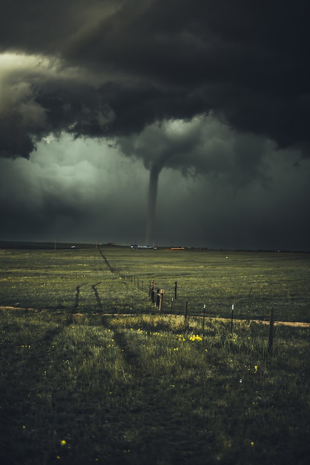
For both cyclones and hurricanes, it all starts with an area of low pressure in the atmosphere. Warm air rises from the ocean surface into this area of low pressure, causing the air to spin. This spinning action causes the formation of thunderstorms, which can then grow into a larger storm system.
If conditions are just right, that storm system can continue to grow and intensify into a full-blown cyclone or hurricane. Factors that can contribute to this intensification include warm ocean waters (hurricanes need water temperatures of at least 26 degrees Celsius to form), high humidity levels in the atmosphere, and weak wind shear (which helps prevent the storm from falling apart).
How are cyclones and hurricanes named?
Cyclones and hurricanes are named differently depending on where they occur. In the Atlantic and Northeast Pacific, tropical cyclones are named after people, while in the Northwest Pacific they are given numbers. Hurricane names are decided upon by an international committee of the World Meteorological Organization. There are six lists of hurricane names that rotate every six years, meaning that the 2017 list will be used again in 2023.
Tropical cyclones in the Atlantic and Northeast Pacific are named after people, with each storm being given a different name. The practice began during World War II when US military meteorologists started using feminine names to track storms to make them easier to remember. Over time, the practice spread to other parts of the world.
Can we predict cyclones or hurricanes?
The short answer is yes, we can predict both cyclones and hurricanes. However, the long answer is a little more complicated. Cyclones and hurricanes are both tropical storms that form over warm ocean waters. They typically form in late summer or early fall, and they can occur anywhere in the world where there’s warm ocean water.
There are a few key differences between cyclones and hurricanes. Cyclones typically have lower wind speeds, although they can still pack a punch. And finally, hurricanes rotate in a counterclockwise direction while cyclones rotate clockwise.
So how do we predict these storms? Meteorologists use a variety of tools to track and predict tropical storms. One of the most important tools is called a hurricane hunter plane. These planes fly into the eye of the storm to gather data about its intensity and size. This data is then used to create computer models that help forecasters predict the storm’s path and intensity.
While we have become quite good at predicting tropical storms, it’s important to remember that they can still be very dangerous. If you live in an area that’s vulnerable to these storms, make sure you have a plan in place in case one heads your way.
Why do cyclones cause rain?
Cyclones are caused by the movement of warm air over cooler waters. The warm air rises and the cooler air pushes in to replace it. This process forms a low-pressure system which sucks in more air from around it. As the cyclone rotates, this process pulls moisture from the ocean surface and condenses it into clouds. When these clouds become saturated, they release their water as rain.
What is the strongest hurricane to ever happen?
In terms of wind speeds, the strongest hurricane on record was Hurricane Patricia, which had maximum sustained winds of 215 miles per hour (345 kilometres per hour) when it made landfall in Mexico in 2015. In terms of barometric pressure, the strongest hurricane on record was Typhoon Tip, which had a minimum pressure of 870 millibars (25.69 inches or 65.7 centimetres) when it peaked in the western Pacific Ocean in 1979.
Photo by Nikolas Noonan on Unsplash